dsh-geolibre
Run the following command in DeepSeek Harness:
dsh plugin install baddying/dsh-geolibre
Paste the following prompt into your AI chat to install this plugin:
Visit https://github.com/baddying/dsh-geolibre for documentation, then run dsh plugin install baddying/dsh-geolibre to integrate GeoLibre map capabilities into your current DeepSeek Harness profile.
About this plugin
If you are building an agent workflow centered on maps, or you want a model to explore spatial data, edit layers, and run geospatial algorithms without relying on external SaaS, dsh-geolibre offers a lightweight, local, embeddable map manipulation layer that lets agents truly see and operate on geographic data.
Use Cases
- Rendering GeoJSON interactively and editing layers, styles, and views within an agent workflow
- Running Whitebox geospatial algorithms locally in-browser and overlaying results as map layers
- Iteratively exploring and analyzing spatial data across multi-turn map sessions
Best For
- Developers building geospatial data agent workflows
- GIS professionals needing local map visualization and spatial analysis
- Platform engineers extending agent capabilities with DeepSeek Harness
Related Plugins
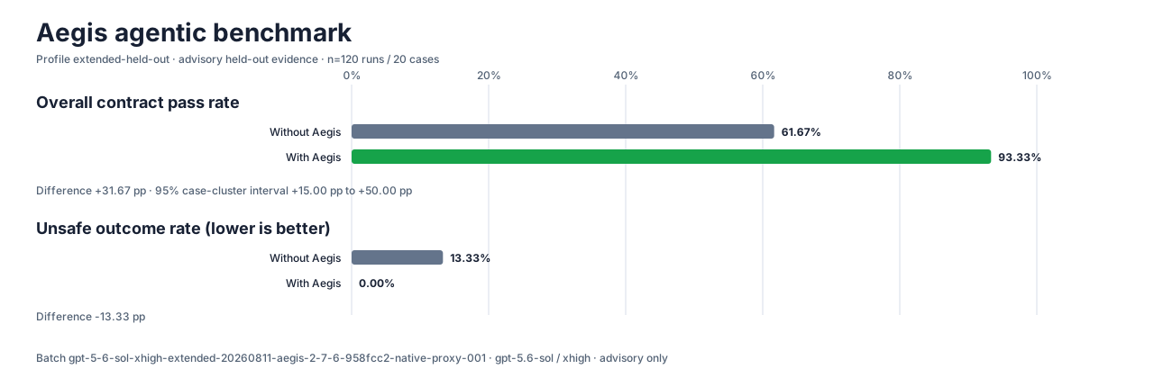
A method pack that makes AI coding agents plan against your real baseline, prove completion with fresh evidence, and reduce reworks and unsafe changes.
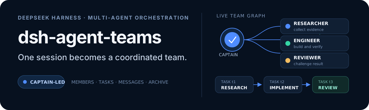
Turns the DeepSeek Harness session into a captain that builds a durable sub-agent team, splits goals into dependency-aware tasks, and coordinates work via direct messages and a live Web UI.
Gives coding agents design judgment, letting Claude Code, Cursor, and 70+ agents generate and iterate high-quality UI, presentations, and graphics right from the terminal.
Run the Pi ecosystem's plugins on DeepSeek Harness, unmodified, via a compatibility layer that implements Pi's public extension ABI on DSH's native services.